
Explore the Burma Road: Walking & Cycling near Aviemore
The Burma Road is one of the classic routes through the Monadhliath Mountains, climbing from Lynwilg near Aviemore before crossing high moorland and descending towards the River Dulnain.
It’s particularly well known as a mountain biking route but it also makes a fantastic long distance walk, which is how we first explored it.
Whichever way you tackle it, expect a fairly relentless climb to begin with, huge views back across Strathspey towards the Cairngorms and, once you’re over the top, a wonderfully quiet stretch of Highland landscape.
What is the Burma Road?
Despite the rather exotic name, we’re still very much in the Highlands.
The old hill track crosses the Monadhliath to the west of Aviemore, beginning near Lynwilg and climbing to a high point of around 690 metres before descending into the Dulnain valley.
Its name is thought to date from the Second World War. Local history has it that the track was improved by prisoners of war and became known as the Burma Road, after the famous Burma Road in Asia which was used to transport supplies during the war.
Today its purpose is rather different. The track has become a favourite with walkers, mountain bikers and gravel riders, offering a wonderfully wild route through the Monadhliath and some enormous views back towards the Cairngorms.
For walkers, the old Burma Road itself makes a roughly 13 mile linear route, while cyclists more commonly incorporate it into a longer circular ride from Aviemore.
Walking the Burma Road
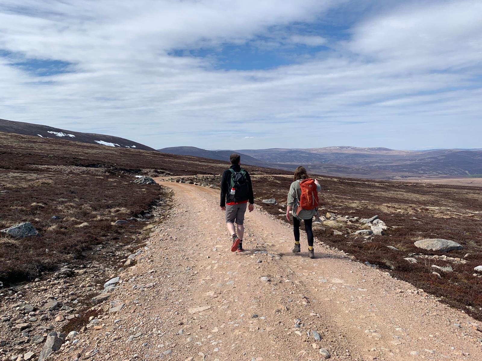
We walked the Burma Road as a linear route, starting at the Lynwilg end and heading north towards the Dulnain valley.
There’s no particularly gentle introduction.
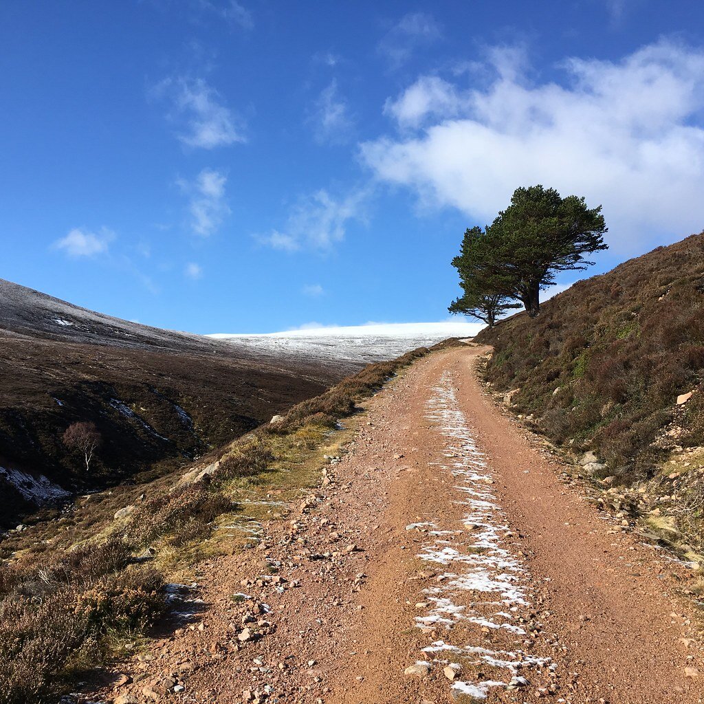
Once you join the track above Lynwilg, it begins a long, sustained climb into the Monadhliath. The surface becomes rougher and rockier as you gain height and we won’t pretend otherwise: the first climb is hard work.
It does, however, have one considerable advantage.
Every time you stop to catch your breath, you have an excellent excuse to turn around and admire the view.
As you climb, Strathspey opens up behind you and the Cairngorm mountains begin to dominate the horizon on the other side of the valley. The higher you go, the better it gets.
Reaching the top
Eventually the climbing eases and you reach the high point of the Burma Road at around 690 metres.
On a clear day, this is the moment that makes all that uphill effort worthwhile.
The Cairngorm massif stretches away across Strathspey while the much quieter Monadhliath landscape surrounds you. It feels remarkably wild considering Aviemore is only a few miles away.
Take your time here. Have some lunch. Take far too many photographs.
You’ve earned it.
Down into the Dulnain valley
From the high point, the track begins its long descent towards the River Dulnain.
The landscape gradually changes as you lose height, with the rough hill track winding through open moorland towards the river.
It’s a very different Cairngorms experience from some of the busier paths around Glenmore and Loch Morlich. Expect big skies, open country and long stretches where you may see remarkably few other people.
The fact that this is a well known cycling route doesn’t mean the surface is smooth. There are rough and rocky sections, so sturdy walking footwear is a good idea.
How difficult is the Burma Road walk?
Technically, the walking isn’t particularly difficult in good conditions. There’s no scrambling and much of the route follows an obvious track.
Physically, however, it’s a substantial day.
The initial climb is long, the full linear walk is around 13 miles and you’re crossing high, exposed Highland terrain.
Allow plenty of time rather than judging the day purely by the distance.
The high point is around 690 metres, so conditions can also be considerably colder and windier than they are down in Aviemore. Check the weather before setting off and carry waterproofs and warm layers even if things look promising at lower level.
How do you walk a linear route?
This is the part that requires a little planning.
Because the full Burma Road walk doesn’t conveniently return you to Lynwilg, you’ll need to arrange transport at the other end. A lift or taxi may be the simplest option, or two cars if you’ve identified suitable and legitimate places to leave them.
We’d avoid relying on informal roadside parking without checking the current situation first.
Alternatively, you can simply walk part of the route from Lynwilg, enjoy the climb and views, and retrace your steps when you’ve had enough.
You won’t complete the crossing but you’ll still experience one of the best parts of the route.
Cycling the Burma Road
It’s regarded as one of the classic mountain biking routes around Aviemore and cyclists generally use the Burma Road as part of a much longer circular ride rather than following our linear walking route.
Different variations exist but a typical loop is somewhere around 40 to 45km, combining the high Burma Road track with other tracks and quieter roads to return to Aviemore.
Don’t let the word road fool you.
This isn’t a gentle cycle along a Highland lane. Expect a sustained climb, loose and rocky sections, exposed moorland and some fast descending. It’s a proper day out and best suited to experienced riders comfortable on rough terrain.
A mountain bike is the obvious choice, although experienced gravel riders also tackle the route depending on their bike, route choice and conditions.
If you’re planning to cycle it, we’d recommend using a current dedicated cycling route for navigation rather than simply following our walking directions.
When is the best time to explore the Burma Road?
Late spring, summer and early autumn give you long daylight hours but conditions matter much more than the date on the calendar.
A clear autumn day can be particularly beautiful, with the moorland turning shades of russet and gold and enormous views across towards the Cairngorms.
Whatever the season, check the forecast before you go. There’s very little shelter once you’re up high and conditions can change quickly.
After prolonged rain, expect wetter and muddier sections too.
What should you take?
Whether you’re walking or cycling, treat the Burma Road as a proper day in the hills rather than a casual trip out from Aviemore.
For walkers, we’d recommend sturdy footwear, waterproofs, warm layers, food and plenty to drink. Take a map and have an offline navigation option available too, rather than relying on mobile reception.
Cyclists should carry the usual tools and spares needed to deal with mechanical problems somewhere fairly remote.
And whichever way you travel, take a camera.
Is the Burma Road worth it?
Absolutely.
There are easier walks and bike rides around Aviemore, and certainly ones requiring less effort and logistical planning. But that’s part of the appeal.
The Burma Road takes you away from some of the National Park’s best known routes and into the quieter Monadhliath while giving you some fantastic views back towards the Cairngorms.
If you’re walking it, the first climb might make you question the wisdom of the whole idea.
The view from the top usually answers that.